I took this picture on my 1996 trip of Rainbow Bridge National Monument. The lake was only a couple of feet below “full pool“
The boat dock was only about 40 yards behind me, so you could bring a full length houseboat all the way up the canyon to within sight of the bridge.
Now it’s more than a mile hike up the canyon.
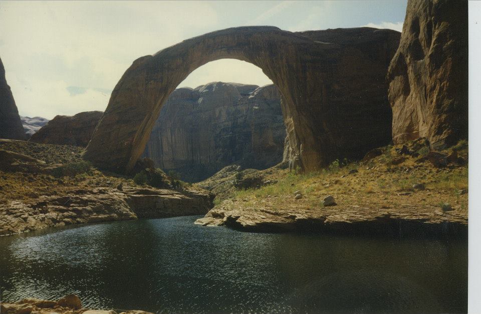
When the dam was completed in the early 60s, it took 20 years for the lake to get to full pool.
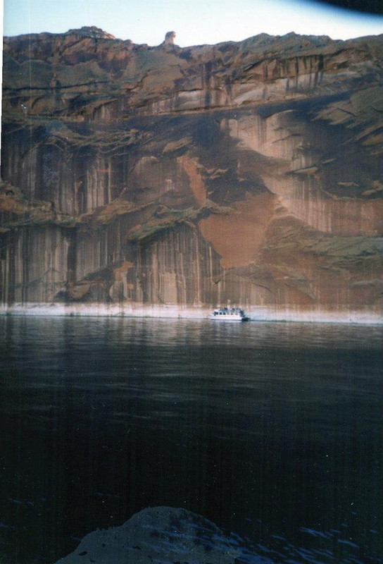
This shot below was taken a year later on my return to the lake in 1997. This was October, as I was on the lake during Halloween. The boat in the picture is about 60 feet long and it is one of the numerous tour boats that will take sightseers out to various spots on the lake. This particular area is on Navajo Canyon on the southern end of the lake where there is a dramatic canyon wall that goes straight up.
You can clearly see the so-called “bathtub ring”, so the lake had dropped almost 20 feet over the course of the preceeding 12 months. The water level is 150 feet below that spot now.
This was near the beginning of the gradual drop in average water level that has gotten the lake to where it is today
The current situation was entirely predictable based on the minimal snowpack experienced in the upper Colorado basin last winter. If you follow Weather news, you may recall that many of the major ski areas delayed their 2025/26 season openings because of the lack of snow in November and December. The Colorado snow pack in particular was something like 50% of normal if I remember correctly.
It’s not just the electricity generated by the Glen Canyon Dam either, but the agriculture that relies on the Colorado river. If you look at Google maps and switch to the satellite shots, you can see the green agriculture areas all along the river downstream of Lake Mead. There’s also a major aqueduct that pulls water out of the Colorado, pumps it over the mountains into the LA basin.
This does not bode well for millions and millions of people.

 = new reply since forum marked as read