Will there be a La Nina this fall? Here's what forecasters predict and what it means for the weather
Last edited Mon Aug 25, 2025, 02:10 AM - Edit history (1)
By Patrick Pester
published 12 hours ago
NOAA forecasts suggest we could experience La Niña conditions in the fall and early winter. However, this potential La Niña spell is unlikely to break records.
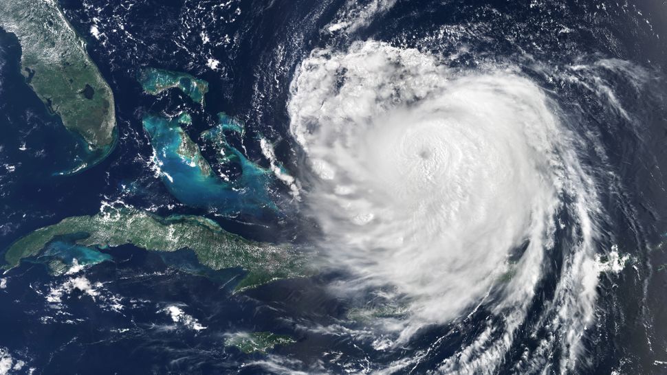
A satellite photo of Hurricane Erin in the Atlantic.
Atlantic hurricanes like Hurricane Erin (pictured here) are more likely to occur during a La Niña. (Image credit: Photo by Gallo Images/Orbital Horizon/Copernicus Sentinel Data 2025 via Getty Images)
La Niña conditions could develop in the fall and early winter, but they will probably be weak and short-lived, forecasters say.
La Niña is the cold phase of the El Niño-Southern Oscillation (ENSO), a natural climate pattern of atmospheric and sea temperature changes in the tropical Pacific Ocean. During La Niña, the jet stream shifts northward, bringing wetter conditions and cooler winters to the northern U.S., while the southern U.S. experiences drier conditions and warmer winters. A La Niña also tends to ramp up hurricane activity over the Atlantic.
Conditions for this phase briefly developed last winter, but they didn't stick around long enough to be considered an official La Niña event in the historical record. The latest ENSO forecast from the National Weather Service indicated that we could be in for something similar in the coming months.
A period of La Niña conditions is favored for the fall and early winter, and there's a 21% chance that the current July-to-September period will qualify. The likelihood then rises to more than 50% for overlapping 3-month periods between September and January. Still, forecasters aren't expecting massive weather shifts.
More:
https://www.livescience.com/planet-earth/weather/will-there-be-a-la-nina-this-fall-heres-what-forecasters-predict-and-what-it-means-for-the-weather