Maps show cold temperatures in eastern U.S., early season lake effect snow due to polar vortex
Source: cbsnews.com
Updated on: November 10, 2025 / 7:39 PM EST
A harsh drop in temperatures is being delivered to the eastern two thirds of the country thanks to a polar vortex dipping down from the Arctic.
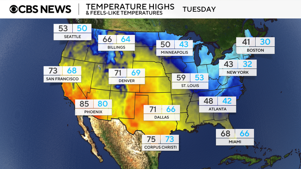
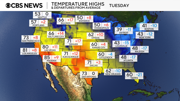
Record cold high temperatures on Monday and Tuesday are expected throughout the South and Southeast along the Gulf Coast states.
mon-highs-1.png
Map shows the expected high temperatures and feels-like temperatures on Monday, Nov. 10, 2025. Nikki Nolan / CBS News
Heavy lake effect snowfall
The cold mixed with a low pressure system moving through the Northeast is transitioning precipitation into snowfall in Michigan, Wisconsin, Illinois, Indiana, Ohio, Pennsylvania and New York. Water temperatures in the Great Lakes are currently ranging from 40 to 50 degrees, which is relatively warmer than the cold air above it. The "warmer" waters are helping to enhance the moisture moving over them and causing the increased snow totals downwind of the lakes.
Chicago issued its first Winter Storm Warning for the Chicago metro area since Jan. 12, 2024. That is over 600 days since the last time the winter weather conditions in Chicago metro warranted a Winter Storm Warning.
........................
Read more: https://www.cbsnews.com/news/maps-us-cold-temperatures-lake-effect-snow-polar-vortex/
We had some snowflakes and some tiny ice balls in mid Wisconsin.
Young niece and nephew begged to go outside and I helped dress them warm but we were all disappointed as we only had the flakes for awhile.
It has been real cold but no snow.
Bow deer hunters in family came home empty--and no snow to track the deer.
 = new reply since forum marked as read
Highlight:
NoneDon't highlight anything
5 newestHighlight 5 most recent replies
= new reply since forum marked as read
Highlight:
NoneDon't highlight anything
5 newestHighlight 5 most recent replies

applegrove
(129,295 posts)snowball/snowman making wet snow. Ah the memories.

progree
(12,548 posts)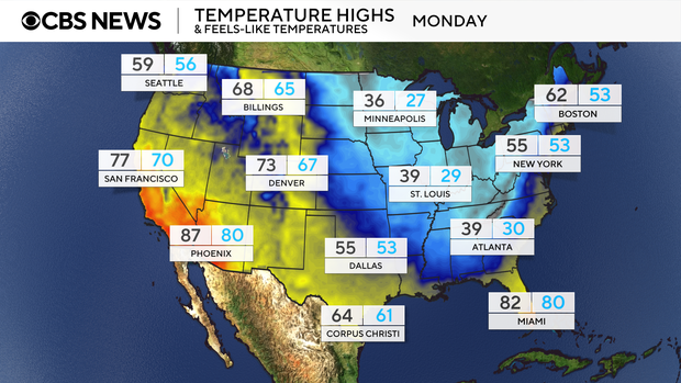
Feels like 30 in Atlanta, ouch

markodochartaigh
(4,639 posts)41° Foreignheit this morning. Yesterday afternoon with temperatures in the mid 60's shoppers at Publix had big puffer jackets on.